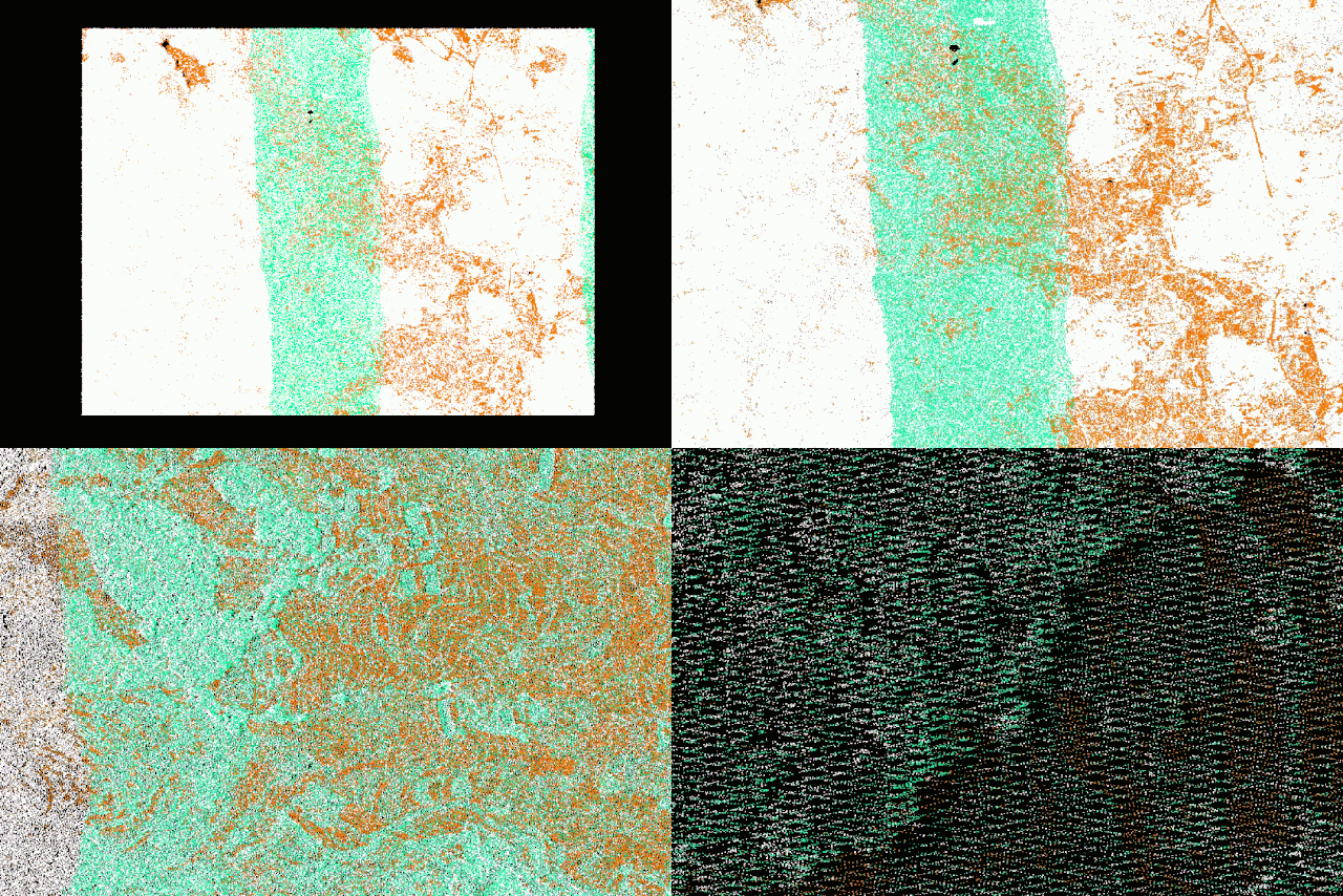
As a novice in surveying,
When you see these dense dots in front of you,
Do they make your vision go black?
What useful surveying information can you obtain?
These points have a lot of potential and can be very useful!
Originally, these are all LiDAR point cloud data. Each point contains three-dimensional coordinate information, also known as the X, Y, and Z elements we often mention. Sometimes they also include color information, reflection intensity information, echo count information, etc.
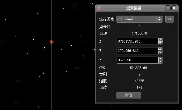
▲ Point Cloud Information Query
First, let’s understand how they are generated
In fact, these points are generated by airborne LiDAR emitting laser signals to the ground and then collecting the reflected laser signals from the ground. Subsequently, through joint computation and deviation correction in post-processing, accurate spatial information of these points can be calculated. What appears to be a simple data acquisition actually involves complex equipment structure and data collection processes.
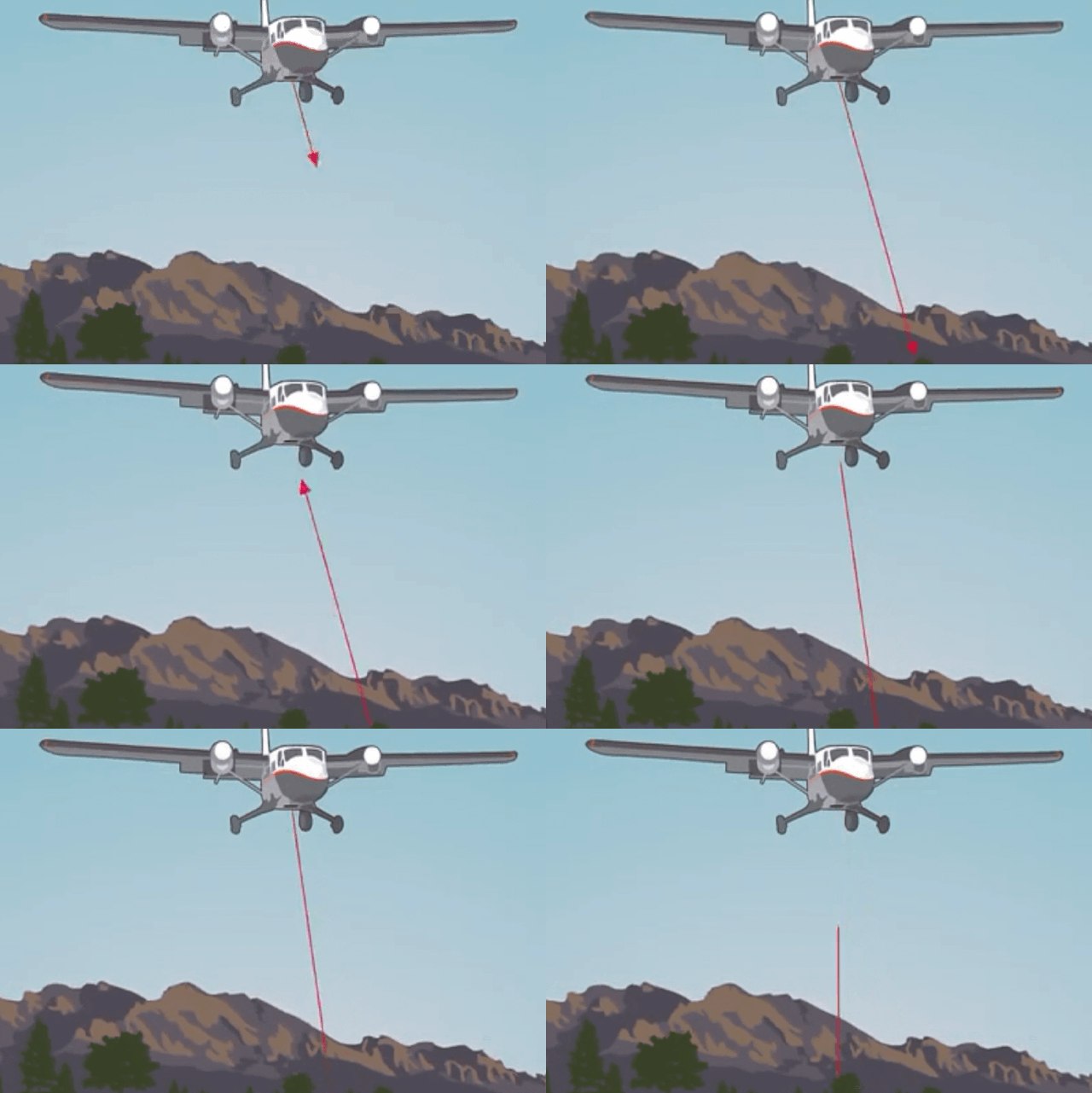
▲Acquisition of airborne LiDAR data
First, LiDAR includes a laser ranging system, an optical mechanical scanning unit, a control recording unit, Global Position System (GPS), Inertial Measurement Unit (IMU), and a set of imaging equipment.
Secondly, when collecting point cloud data with airborne LiDAR, in addition to meeting the flight conditions due to weather, it is also necessary to obtain airspace permission, design flight routes in advance and conduct on-site surveys.
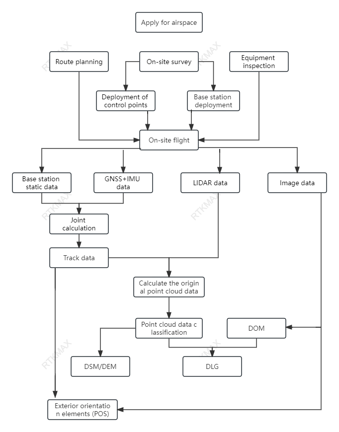
▲ Point cloud data acquisition and processing process
The scattered points we saw in the previous text cannot provide useful information because they were not opened in the correct way.
The correct way to open them is as follows:
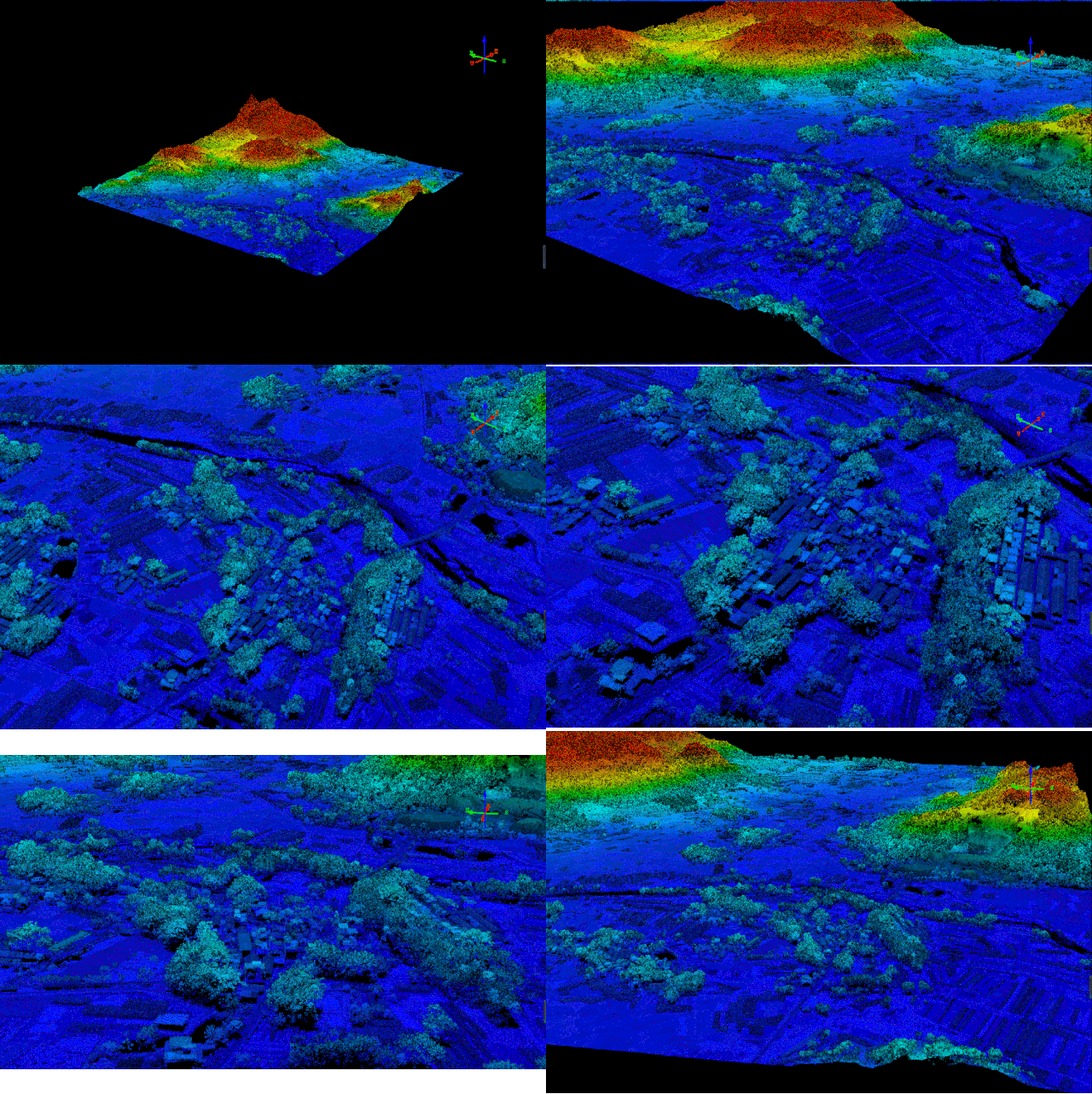
▲3D point cloud preview
Three-dimensional preview is just the basic surface feature of point clouds, because each point cloud has spatial coordinate information, they all have measurement capabilities. Two points form a line, three points form a plane, and four points form a solid. Through these points, not only can the coordinate information of a certain point on the earth’s surface be clearly understood, but also various measurements such as length, area, volume, angle can be calculated between them. This perfectly meets the requirements for measurement needs.
What can point cloud data be used for?
01
Can be used to create digital elevation models.
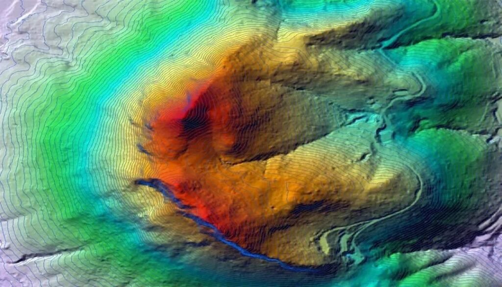
▲Digital Elevation Model and Contour Lines
02
Can be used for 3D modeling.
With the gradual maturity of LiDAR technology, the high precision and wide applicability of 3D models produced by LiDAR technology have reduced field work and saved time and effort. It has played an important role in extracting building outlines, detecting feature points, and reconstructing 3D models. In addition, when combined with oblique photography technology, object extraction becomes more convenient and data visualization is enhanced.
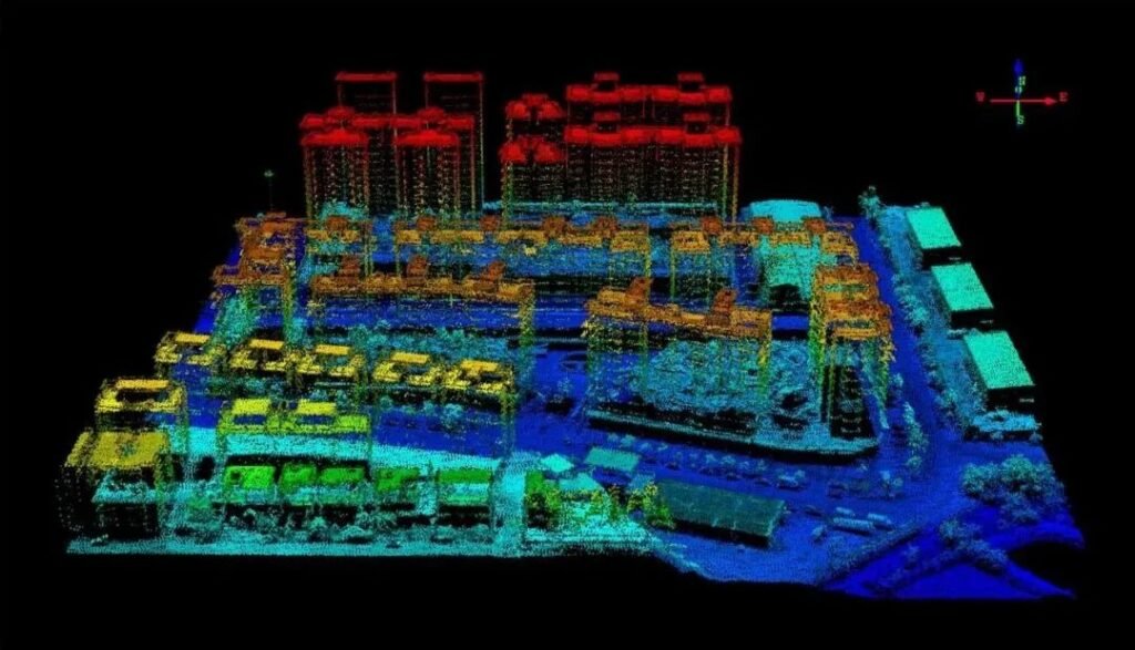
▲Point Cloud 3D Model
03
Can be used for agricultural and forestry surveys.
Airborne LiDAR point clouds can be used to survey the characteristics of forest trees, such as average tree height, crown density, biomass, timber volume, and vegetation coverage. If combined with a hyperspectral imager, more information can be determined, such as vegetation classification, vegetation volume, soil changes, etc. Furthermore, derived data can be used to monitor forest growth and damage caused by storms or fires.
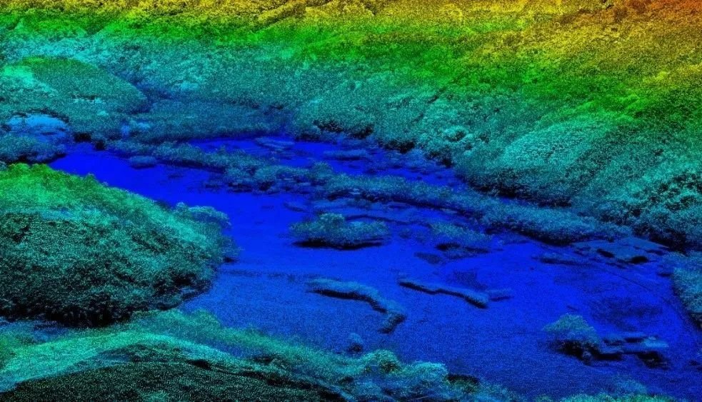
▲Display of overall distribution of forest resources
04
Can be used for earthwork calculation.
High-precision laser point cloud can be used to construct a three-dimensional terrain model, providing section measurement, slope and aspect measurement, earthwork volume information for survey and design, greatly reducing the field work in engineering survey and design, shortening the working period.
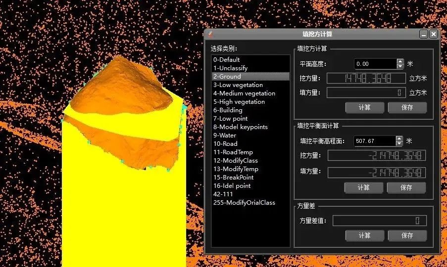
▲ Point cloud calculation of earthwork volume
05
Can be used to monitor geological hazards
By establishing a three-dimensional model of the terrain, it is possible to monitor changes in the terrain on a large scale. Based on the direction and amount of terrain change, risk assessments can be made to provide a basis for preventing geological disasters. For example, monitoring the surface of landslide bodies, especially in areas prone to landslides such as roads and railways under steep slopes, as well as slope cutting for construction, can provide important evidence for inferring the causes and development trends of landslides.
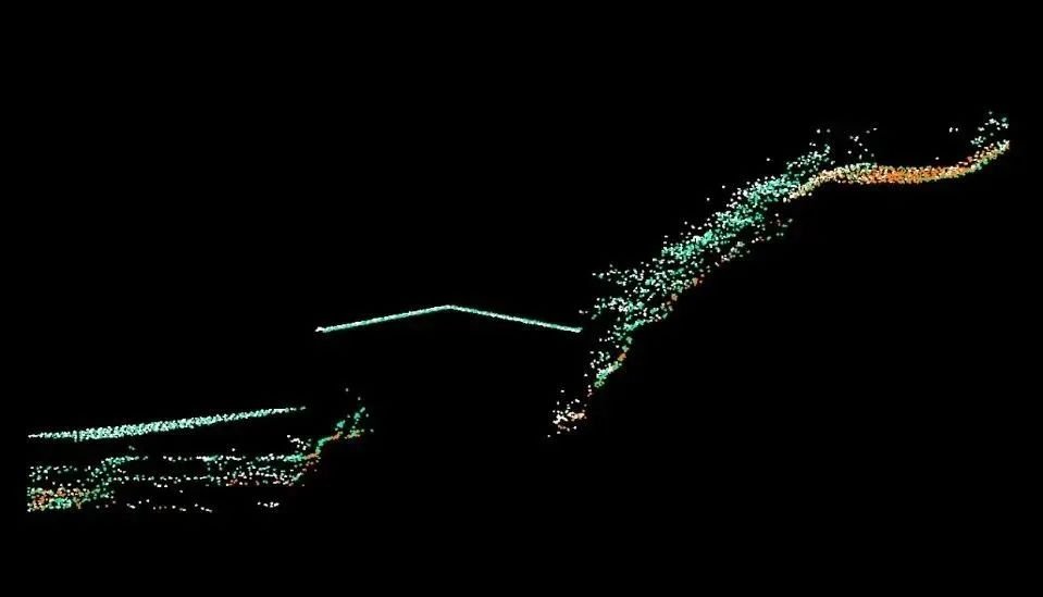
The above five aspects are only part of the application of point cloud data.
Because LiDAR has the following characteristics:
- Works in all weather conditions and actively acquires data.
- Good concealment, strong resistance to active interference, and wide range of data acquisition.
- Strong laser penetration ability.
- Requires less field work.
- High accuracy of point cloud and accurate spatial coordinate information.
Therefore, point cloud data obtained from LiDAR is often applicable in various fields such as resource exploration, urban planning, agricultural development, water conservancy engineering, environmental monitoring, mining measurement, tunnel measurement, highway road measurement, cable monitoring, deep-sea measurement in oceans.
That’s all for today’s introduction to LiDAR point cloud data. Did you get it?
What are some common devices for collecting laser point clouds? (Please leave a comment in the discussion section.)

