What role does multi-beam survey technology play in the safety risk monitoring and management of bridges and flood walls?

Compared with single-beam systems, the data collected by multi-beam measurement systems are more detailed and intuitive. This technology will be increasingly used in future underwater terrain surveys.
Cost-Effective Survey Instruments Reduce Costs and Increase Efficiency for Your Projects

Are you looking to cut costs and boost efficiency in your surveying projects? At RTKMAX, we know that achieving these goals is crucial for success in the competitive world of construction, mining, and land surveying. The secret lies in choosing the right survey instruments that offer high quality at an affordable price.
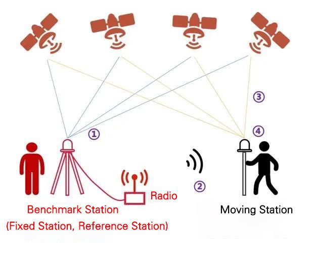
What is the Principle Behind Setting Up an RTK Base Station?

Are you intrigued by the precision of RTK (Real-Time Kinematic) positioning but puzzled about how its base stations work? Understanding the setup of RTK base stations is crucial for accurate and efficient surveying. Let’s break down the principles behind this advanced GPS technology.
How to improve the accuracy of RTK surveying ? How to verify the accuracy of RTK?

Regarding how to improve the RTK surveying accuracy in surveying work and how to verify the RTK accuracy, this article discusses it from theoretical knowledge and practical project cases.
Recently, ionospheric disturbances have been frequent. Which method should be chosen for RTK surveying operations?

Are you struggling with ionospheric disturbances affecting your RTK surveying accuracy? You’re not alone. Many surveyors are facing similar issues, leading to questions about which RTK method is best during such conditions. Let’s dive into the differences between the “1+1” and CORS methods to help you make an informed decision.
What is RTK projection? How to choose?

The commonly used RTK projections are divided into three types: Gauss projection, Mercator projection, and Lambert projection. In the following text, let me introduce these three projections in detail.
