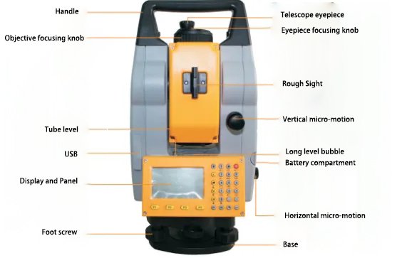
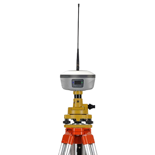
When using RTK for various surveying and stakeout operations, surveyors often encounter many professional terms. Some surveyors are not clear about the meanings of these professional terms. The editor has collected and organized 36 common RTK measurement terminology explanations.

I. Various RTK Solution Status Terms
- Fixed Solution: Indicates that the integer ambiguity has been resolved and the measurement has been initialized. It is the most accurate type of solution.
- Float Solution: Indicates that the integer ambiguity has been resolved, but the measurement has not been initialized.
- Single Point Solution: 3D coordinates calculated by the receiver without using any differential correction information.
- Pseudorange: The measured distance derived from the time it takes for a ranging code signal transmitted by a satellite to reach the GPS receiver, multiplied by the speed of light.
II. RTK Reference Station and Rover Station Names
- Reference Station (Base Station): One or several receivers continuously track satellites at one or several fixed survey points for a certain observation period. The other receivers move within a certain range of these stations, which are called reference stations.
- Rover Station (Mobile Station): A receiver that moves within a certain range of a reference station and provides real-time three-dimensional coordinates.
III. Common Terms in RTK Mode Settings
- Elevation Mask Angle: A shielding elevation angle set to block obstructions (like buildings, trees, etc.) and multipath effects. Satellites below this angle are not tracked.
- Position Dilution of Precision (PDOP): A unitless number indicating the relationship between user position error and satellite position error. It reflects the factor of positioning accuracy deterioration related to the spatial geometric distribution of the measured satellites. The larger the spatial distribution, the lower the PDOP value, and the higher the positioning accuracy; conversely, the higher the PDOP value, the lower the positioning accuracy.
- SBAS Option: Mainly used for satellite-based augmentation. Normally, this option can be turned off.
- RTCM23/30/32: RTCM is a standard differential protocol. RTCM23/30/32 are different versions of it, containing different raw data.
- Single Point Coordinates/Designated Point Coordinates: Set up at known points to start with designated point coordinates, and at unknown points to start with single point coordinates.
- TCP (Transmission Control Protocol): A connection-oriented, reliable, byte stream-based communication protocol of the transport layer.
- NTRIP (Networked Transport of RTCM via Internet Protocol): A standard network transmission differential mode, commonly used in CORS networks.
- DOP (Dilution of Precision): Dilution of Precision (DOP) is a quality indicator for GNSS positioning. It considers the position of each satellite relative to others in the constellation and their geometric position relative to the GNSS receiver. The smaller the DOP value, the higher the reliability of the accuracy. The standard DOP values for GNSS applications are: PDOP (Position – 3D coordinates), RDOP (Relative – position, mean time), HDOP (Horizontal – 2D horizontal coordinates), VDOP (Vertical – height only), TDOP (Time – clock offset only).
IV. Common Terms Used in RTK Measurement
- Multipath: Interference (similar to ghosting on a TV screen). Multiple paths of GNSS signals reaching the antenna before they converge.
- Multipath Effect: The satellite signal (reflected wave) reflected by reflectors around the survey station entering the receiver antenna interferes with the direct signal (direct wave) coming directly from the satellite, causing the observed value to deviate, producing the so-called “multipath error”. This interference time delay effect caused by signal propagation through multiple paths is known as the multipath effect.
- Real-Time Kinematic (RTK): RTK positioning technology is a real-time dynamic positioning technology based on carrier phase observation values, providing real-time three-dimensional positioning results of the survey point in the designated coordinate system with centimeter-level (1-10cm) positioning accuracy.
- Network RTK (CORS/VRS): Refers to establishing multiple base stations in a certain area, forming a network-like coverage over the area, and continuously tracking and observing to form a network of satellite positioning observation values. RTK correction parameters covering the area and the time period are obtained through this network to provide real-time RTK corrections for positioning within the area.
- PPK (Post-Processed Kinematic GPS): PPK technology is the earliest GPS dynamic differential technology method, also known as stop-and-go. The main difference between it and RTK technology is that it does not require real-time data transmission between the base station and the rover like RTK technology. Instead, after positioning observation, joint post-processing of positioning data collected by both receivers is carried out to calculate the coordinates of the rover at the corresponding position. There is no strict limit on the distance between the base station and the rover.
- Differential Positioning: Accurate measurement of the relative position of two receivers tracking the same satellites simultaneously.
- Pseudorange Differential (DGPS): Pseudorange differential measurement technology uses GPS codes (C/A codes) for positioning. Differential measurements do not require initialization or continuous satellite tracking. The measurement accuracy can only reach 1-3 meters. If carrier phase smoothing is added to the pseudorange, pseudorange differential can achieve sub-meter accuracy.
V. Coordinate Systems, Elevation Systems, and Time Systems
- Coordinate System: RTK measurements use the WGS84 system. When RTK measurements are required to provide other coordinate systems , coordinate conversion should be performed.
- Elevation System: The elevation system uses the normal height system.
- Time System: RTK measurements should use Coordinated Universal Time (UTC). When using Beijing Standard Time (BST), consider the time zone difference with UTC. This is particularly important when RTK is used as a timer.
VI. Common Sources of Error in RTK Measurement
- Receiver Clock Error: GPS receivers generally use high-precision quartz clocks. The difference between the receiver’s clock face time and GPS standard time is called the receiver clock error.
- Receiver Position Error: The error of the receiver antenna phase center relative to the center position of the station benchmark is called receiver position error.
- Receiver Antenna Phase Center Deviation: In GPS measurement, observation values are based on the position of the receiver antenna’s phase center. The phase center of the antenna should theoretically remain consistent with its geometric center. However, during observation, the phase center of the antenna changes with the strength and direction of the signal input. This difference is called the deviation of the antenna phase center position.
VII. Other Terminology
- PPM (Parts Per Million): A measurement correction for every one million parts of slant range, applicable to the effect of the Earth’s atmosphere. The PPM is determined using observed pressure and temperature as well as specific instrument constants.
- RMS (Root Mean Square): Used to represent the measurement accuracy of a point. It is the error radius of the circle within which approximately 70% of the location-fixed points fall.
- SNR (Signal-to-Noise Ratio): A measure of satellite signal strength. The range of SNR is from 0 (no signal) to 99, with 99 being the best and 0 meaning the satellite is not available. A typical good value is 40. Generally, GNSS systems start using satellites when the SNR value is above 25.
- Weighting Index: Used in neighborhood adjustment calculations. When applied to new point coordinates calculated from each new point, the calculated distances from each new point to the control points used in the establishment of the station are weighted according to the weighting index.
- Stake Distance/Station Distance: The distance or interval along a line, arc, or road.
- Projection: Used to produce a flat map representing the Earth’s surface or part of it.
- Ellipsoid: A mathematical model of the Earth formed by rotating an ellipse around its short axis.
- Geodetic Datum: A mathematical model designed to fit part or all of the geoid (physical Earth’s surface).
- Geoid: A surface of gravitational equipotential very close to mean sea level.


