When we use RTK for measurement operations, we often encounter projection problems. So what is RTK projection? The commonly used RTK projections are divided into three types: Gauss projection, Mercator projection, and Lambert projection. In the following text, let me introduce these three projections in detail.
1. Gauss-Krüger Projection:
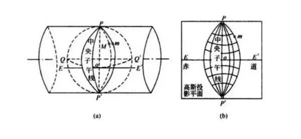
This projection was developed by German mathematician, physicist, and astronomer Gauss in the 1820s. Later, it was supplemented by German geodesist Krüger in 1912 with additional projection formulas, hence it is called the Gauss-Krüger Projection. It is also known as Transverse Mercator Projection or Tangent Cylindrical Projection and is a variation of the Mercator Projection.
The Gauss projection is a conformal projection.
Generally speaking, the Gauss projection can be divided into three-degree or six-degree zones.

2.Mercator Projection
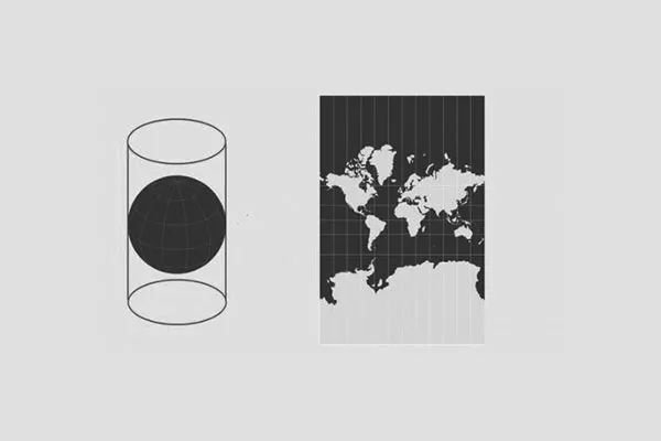
The Mercator projection is a type of equal-angle cylindrical map projection. The projection was originally created to accurately display compass directions, providing assurance for maritime navigation. Another function of this projection is its ability to define all local shapes precisely and clearly at the smallest scale. It was proposed by Gerardus Mercator in 1569. The Web Mercator variant of the projection has become the de facto standard for web maps and online services. It is applicable to ArcGIS Pro 1.0 and higher versions as well as ArcGIS Desktop 8.0 and higher versions.
The Mercator projection is a type of cylindrical projection.

3.Lambert projection
The Lambert projection is a conformal conic projection devised by the German mathematician Lambert (J.H.Lambert). The Lambert projection is divided into three types: normal axis, transverse axis, and oblique axis based on the relative position of the projection surface to the Earth’s surface. In the normal axis projection, parallels are concentric circles with intervals gradually decreasing outward from the center of projection, while meridians are concentric circle radii. In the transverse axis projection, the central meridian and equator are perpendicular straight lines, and other meridians and parallels are curves symmetric to the central meridian and equator respectively. In oblique axis projections, the central meridian is a straight line while other meridians are curves symmetric to it. This projection has no area distortion; angular and length distortions increase outward from the center of projection. Transverse-axis projections and oblique-axis projections are more commonly used for maps of eastern and western hemispheres as well as continental maps. Commonly used ones include Lambert equal-area conic projections and Lambert equal-area azimuthal projections – where former belongs to normal-axis equal-angle conic projections while latter belongs to normal-axis equal-area azimuthal projections.


