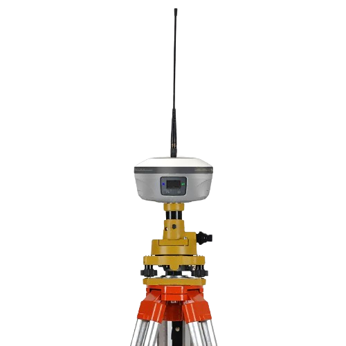
Currently, there is a significant increase in demand for real-world 3D applications across various industries. Fields such as architectural information updates, engineering construction and monitoring, cultural heritage preservation, and architectural design are actively exploring and applying real-world 3D technology.
This article introduces a practical case of the three-dimensional repair survey of a pavilion building in a certain community to demonstrate the actual application of video measurement RTK in three-dimensional repair surveys. It also explains how video measurement RTK achieves fine-grained 3D modeling of the internal and external structures of the pavilion.
Industry Pain Points
Before the application of video measurement RTK, three-dimensional modeling tasks in aerial surveying were usually carried out using unmanned aerial vehicle (UAV) oblique photography modeling methods. However, this method has some industry pain points:
01
Limited aerial surveying perspectives
In certain specific areas or structures, the aerial surveying perspective of UAVs is restricted, making it impossible to obtain comprehensive modeling data. This results in data gaps or incompleteness in the modeling outcomes within buildings or obstructed areas.
02
Lack of accurate position information (POS) for photo reconstruction:
When conducting supplementary photography, photos taken with tablets or ordinary cameras often lack accurate position information. This leads to misalignment between photos and UAV data during subsequent photogrammetric processing, affecting the accuracy and consistency of the modeling.
03
Time-consuming and labor-intensive manual photo reconstruction
Attaching photos to reconstruction software for patchwork requires manual operation, which not only has low efficiency but also consumes a significant amount of time and manpower resources.
By combining video measurement RTK with UAVs for refined modeling, these pain points can be effectively addressed, providing efficient and precise modeling solutions.
Case Study
During the implementation process, due to the partial structure of the pavilion being obscured by the eaves, traditional unmanned aerial vehicle (UAV) surveying techniques often cannot accurately model the interior structure of the pavilion where there is obstruction, resulting in distortion, voids, and artifacts. Video measurement RTK, as an innovative solution that integrates satellite navigation, inertial navigation, and video photogrammetry technologies, not only meets current industry needs but also provides efficient and accurate measurement and modeling tools for real-world 3D applications. Video measurement RTK integrates GNSS+IMU+dual cameras with complementary perspectives on shooting angle, position, and aerial survey perspective. In obstructed areas, video measurement RTK can continuously capture dynamic videos from a horizontal perspective and automatically generate photos with POS information. These photos can be jointly modeled with aerial survey data to ensure accurate capture of the texture of the interior structure of the pavilion.

Waiting for three-dimensional modeling of the pavilion
RTK Advantages
Improving efficiency of field data collection
The shooting perspective, position, and aerial survey perspective of video measurement RTK naturally complement each other. It can achieve continuous video shooting of the object to be measured from a horizontal angle for areas with limited or obstructed aerial survey perspectives, and automatically generate photos with POS information in the measurement software backend. This enables clear modeling data to be obtained in areas prone to blurred images due to obstructions during aerial surveys, reducing data loss or incompleteness. Compared to traditional methods of patching up aerial surveys, video measurement RTK does not require manual point-by-point patching operations, doubling the efficiency of field data collection.
Optimize the efficiency of internal data processing
Video measurement RTK also has high efficiency in internal data processing. After shooting the video, the automatically generated photo data with POS information by video measurement RTK can be synchronized with drone data for aerial triangulation and modeling operations. Compared to traditional methods that require manual operation for photo texture mapping and patching, the data processing process of video measurement RTK is more automated and efficient. The data from video measurement RTK supports mainstream modeling software such as ContextCapture without needing to set connection points or control points. This greatly simplifies the steps of internal data processing, saving time and labor costs.
Joint refinement modeling process
When using video measurement RTK and drones for joint refinement modeling, first conduct field data collection. Use video measurement RTK and drones to respectively capture the objects to be measured, and export their own photos and position data (POS). Then perform indoor data processing. Taking ContextCapture as an example, create a new project in the ContextCapture software and establish two blocks for processing RTK data and drone data separately. Perform aerial triangulation calculations on these two sets of data separately to solve for the camera’s interior and exterior orientation elements. After completing the aerial triangulation, merge the two blocks to generate joint modeling results.
Since both RTK and drones have the same coordinate system and high-precision position data, it is possible to directly merge the blocks without setting connection points or control points, thereby significantly improving efficiency in both fieldwork and indoor work.

Video measurement RTK and drone joint fine modeling process diagram
Field Data Collection Process
Using RTK and drones for separate filming
Video measurement of RTK ground shooting
Using the “modeling mode” of video measurement RTK, adjusting the middle pole to 1.8m and 2m respectively, taking two sets of 360° videos of the pavilion from different heights, and capturing close-up shots of the interior structure of the pavilion corridor, such as pavilion pillars, to ensure complete coverage of the entire structure in order to capture precise model details.

Video measurement RTK ground collection process
Unmanned Aerial Vehicle Aerial Photogrammetry
Using an unmanned aerial vehicle equipped with a five-lens camera for aerial photography.

Unmanned aerial vehicle aerial survey data collection process
Export Data
Export the photos and POS data of the drone separately, as well as the photos taken by video measurement RTK (the photos come with accurate POS information and do not need to be exported separately), which can be conveniently processed for subsequent use.
Processing of internal data
Importing drone and video measurement RTK data
(1) Create a new project in ContextCapture software, and create two blocks for processing drone data and video measurement RTK data respectively.
(2) Within each block, perform the following steps: add images, set intrinsic parameters.
*Add images: Click “Add Images” – “Add Entire Directory” on the “Images” page of the block.
*Set intrinsic parameters: Click “More” in the image group on the right side, and set camera intrinsic parameters, focal length, and sensor size.

Import video measurement RTK data into CC
Block-based aerial triangulation
For each block, perform aerial triangulation calculations to solve for the interior and exterior orientation elements of each camera.
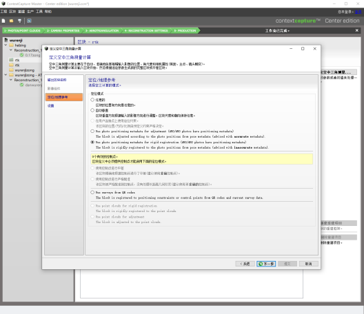
Video measurement RTK data submission aerial triangulation
Block empty three results

Video measurement RTK data aerial triangulation results
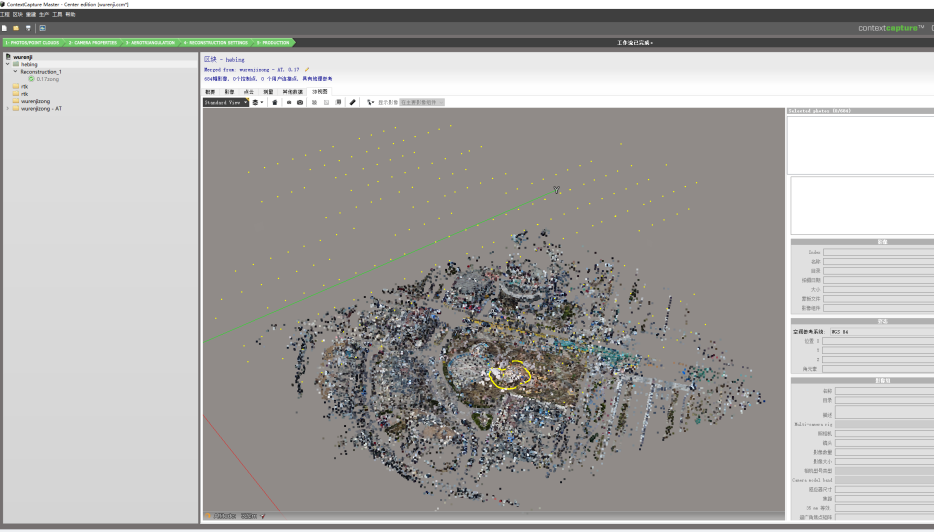
Unmanned aerial vehicle data empty three results
Merge three blocks of empty space
Blocks after aerial triangulation will have a “-AT” suffix, select and merge the blocks from RTK and drones
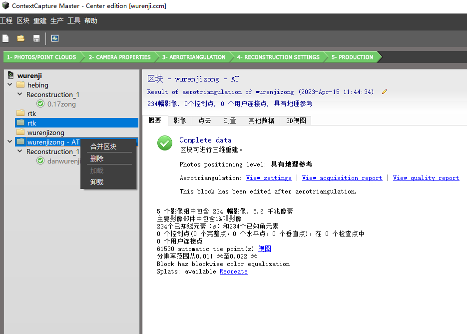
Merge empty three results
Submit reconstruction business
(1) Create a new reconstruction project for the merged blocks.
(2) Choose the format output by the model, using .OSGB format as an example this time.
(3) Set spatial reference system, area of interest boundary, and chunking method in the “Spatial Framework” page.
(4) Submit a new production project with relevant settings on the “Summary” page (default settings can be selected).
Submit to obtain the joint modeling results
Comparison of Modeling Results
Compared with modeling based solely on drone data, the advantages of video measurement RTK and joint modeling with drones are evident. It can overcome the limitations of traditional drone aerial surveying in specific scenarios, allowing users to obtain clear and complete information about the internal and external structures of buildings. This provides reliable data support for project decision-making, design planning, and construction management.
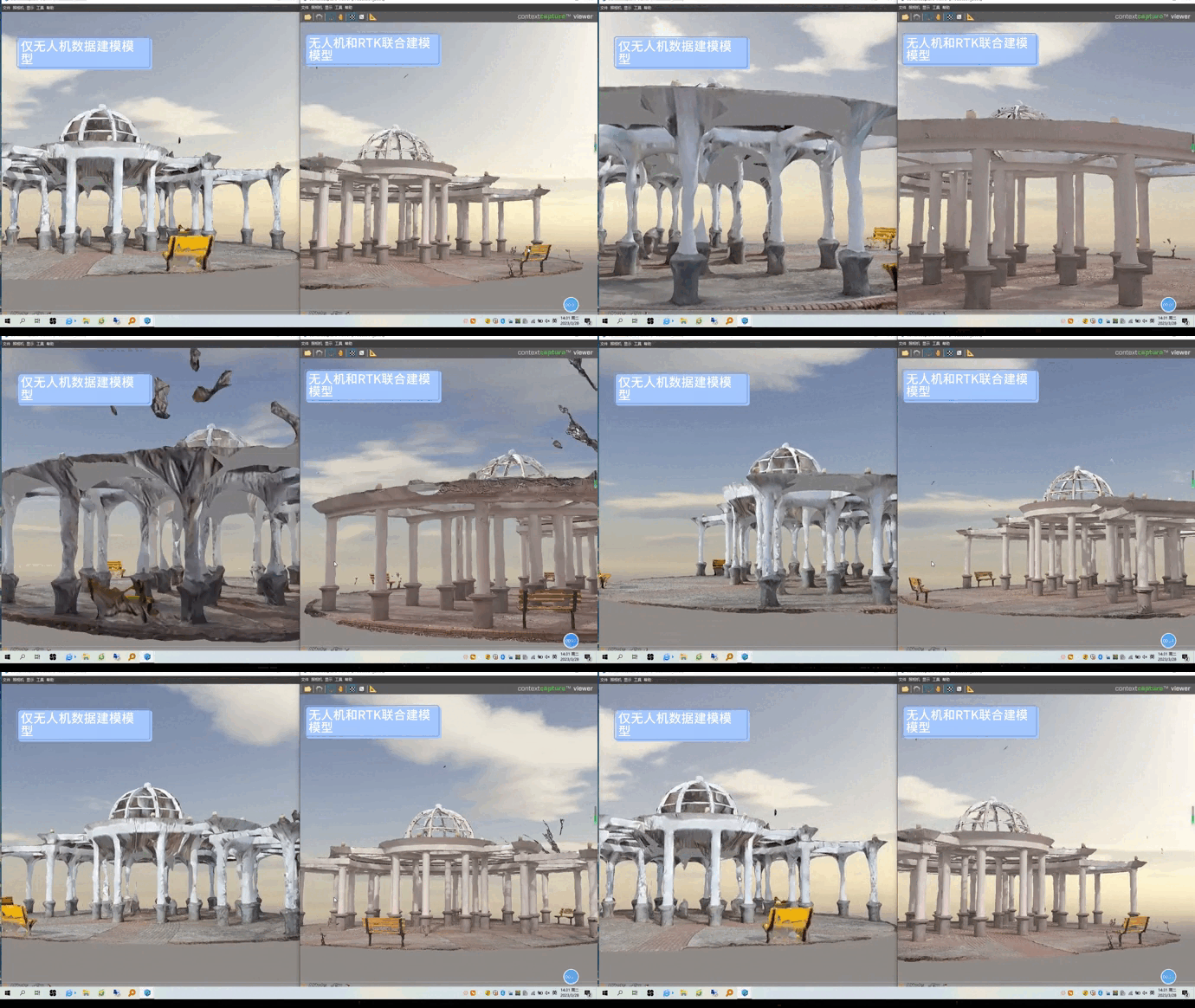
Comparison of modeling results
END
